- Title
- Stanowiska dokumentacyjne
- Abstract
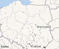
Granice stanowisk dokumentacyjnych - niewyodrębniających się na powierzchni lub możliwych do wyodrębnienia, ważnych pod względem naukowym i dydaktycznym, miejsc występowania formacji geologicznych, nagromadzeń skamieniałości lub tworów mineralnych, jaskiń lub schronisk podskalnych wraz z namuliskami oraz fragmentów eksploatowanych lub nieczynnych wyrobisk powierzchniowych i podziemnych
- License
- Public Domain Dedication (CC0)
-
+ No Copyright
+ The person who associated a work with this deed has dedicated the work to the public domain by waiving all of his or her rights to the work worldwide under copyright law, including all related and neighboring rights, to the extent allowed by law.
+
+ You can copy, modify, distribute and perform the work, even for commercial purposes, all without asking permission. See Other Information below.
+
+ Other Information
+ In no way are the patent or trademark rights of any person affected by CC0, nor are the rights that other persons may have in the work or in how the work is used, such as publicity or privacy rights.
+ Unless expressly stated otherwise, the person who associated a work with this deed makes no warranties about the work, and disclaims liability for all uses of the work, to the fullest extent permitted by applicable law.
+ When using or citing the work, you should not imply endorsement by the author or the affirmer.
+ For more info see https://creativecommons.org/publicdomain/zero/1.0/. - Publication Date
- Dec. 31, 2020, 11:42 a.m.
- Type
- Vector Data
- Keywords
- ochrona przyrody stanowiska dokumentacyjne
- Category
- Environment
- environmental resources, protection and conservation. Examples: environmental pollution, waste storage and treatment, environmental impact assessment, monitoring environmental risk, nature reserves, landscape
- Regions
- Global, Europe, Poland
- Approved
- Yes
- Published
- Yes
- Featured
- No
- DOI
- None
- Name
- MRIPAS
- openforestdata@pb.edu.pl
- Position
- None
- Organization
- None
- Location
- Voice
- None
- Fax
- None
- Identification Image
-


- Spatial Extent
- ---
- Projection System
- EPSG:4326
- Extension x0
- 14.622272491455100
- Extension x1
- 23.432081222534200
- Extension y0
- 49.404876708984400
- Extension y1
- 54.806068420410200
- Language
- Polish
- Supplemental Information
Nie umieszczono informacje
- Spatial Representation Type
- vector data is used to represent geographic data
- Name
- MRIPAS
- openforestdata@pb.edu.pl
- Position
- None
- Organization
- None
- Location
- Voice
- None
- Fax
- None
- Link Online
- /layers/geonode_data:geonode:StanowiskaDokumentacyjne_wgs84
- Metadata Page
- /layers/geonode_data:geonode:StanowiskaDokumentacyjne_wgs84/metadata_detail
- Thumbnail
- Stanowiska dokumentacyjne.png
- Remote Thumbnail
- Stanowiska dokumentacyjne.png
- Legend
- Stanowiska dokumentacyjne.png
- Spakowany Shapefile
- Stanowiska dokumentacyjne.zip
- GeoJSON
- Stanowiska dokumentacyjne.json
- Excel
- Stanowiska dokumentacyjne.excel
- CSV
- Stanowiska dokumentacyjne.csv
- GML 3.1.1
- Stanowiska dokumentacyjne.gml
- GML 2.0
- Stanowiska dokumentacyjne.gml
- Zipped Shapefile
- Stanowiska dokumentacyjne.zip
- PNG
- Stanowiska dokumentacyjne.png
- Stanowiska dokumentacyjne.pdf
- JPEG
- Stanowiska dokumentacyjne.jpg
- Original Dataset
- Stanowiska dokumentacyjne.zip
- OGC WFS: geonode Service
- Geoservice OGC:WFS
- OGC WMS: geonode Service
- Geoservice OGC:WMS
- Name
- MRIPAS
- openforestdata@pb.edu.pl
- Position
- None
- Organization
- None
- Location
- Voice
- None
- Fax
- None