- Title
- Granice Polski | Atlas rozmieszczenia ssaków w Polsce
- Abstract
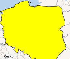
Warstwa wektorowa przedstawiająca granice terytorium Polski. Warstwa wstawiona jako jedna z bazowych dla map rozmieszczenia ssaków w Polsce.
Vector layer of the borders of Poland. Uploaded as a base map for the Atlas of Polish mammals
- License
- Public Domain Dedication (CC0)
-
+ No Copyright
+ The person who associated a work with this deed has dedicated the work to the public domain by waiving all of his or her rights to the work worldwide under copyright law, including all related and neighboring rights, to the extent allowed by law.
+
+ You can copy, modify, distribute and perform the work, even for commercial purposes, all without asking permission. See Other Information below.
+
+ Other Information
+ In no way are the patent or trademark rights of any person affected by CC0, nor are the rights that other persons may have in the work or in how the work is used, such as publicity or privacy rights.
+ Unless expressly stated otherwise, the person who associated a work with this deed makes no warranties about the work, and disclaims liability for all uses of the work, to the fullest extent permitted by applicable law.
+ When using or citing the work, you should not imply endorsement by the author or the affirmer.
+ For more info see https://creativecommons.org/publicdomain/zero/1.0/. - Publication Date
- Sept. 24, 2021, 8:08 a.m.
- Type
- Vector Data
- Keywords
- Atlas Poland Polska
- Category
- Boundaries
- legal land descriptions. Examples: political and administrative boundaries
- Regions
- Poland
- Approved
- Yes
- Published
- Yes
- Featured
- No
- DOI
- None
- Name
- MRIPAS
- openforestdata@pb.edu.pl
- Position
- None
- Organization
- None
- Location
- Voice
- None
- Fax
- None
- Identification Image
-


- Spatial Extent
- ---
- Projection System
- EPSG:4326
- Extension x0
- 14.145554542541500
- Extension x1
- 24.144718170166000
- Extension y0
- 49.001937866210900
- Extension y1
- 54.836940765380900
- Language
- English
- Supplemental Information
Nie podano informacji
- Spatial Representation Type
- vector data is used to represent geographic data
- Name
- Beata Bramorska (beata_bramorska)
- bbramorska@ibs.bialowieza.pl
- Position
- None
- Organization
- Mammal Research Insitute Polish Academy of Sciences
- Location
- Voice
- None
- Fax
- None
- Link Online
- /layers/geonode_data:geonode:Polska0
- Metadata Page
- /layers/geonode_data:geonode:Polska0/metadata_detail
- Thumbnail
- Granice Polski | Atlas rozmieszczenia ssaków w Polsce.png
- Remote Thumbnail
- Granice Polski | Atlas rozmieszczenia ssaków w Polsce.png
- Legend
- Granice Polski | Atlas rozmieszczenia ssaków w Polsce.png
- Spakowany Shapefile
- Granice Polski | Atlas rozmieszczenia ssaków w Polsce.zip
- GeoJSON
- Granice Polski | Atlas rozmieszczenia ssaków w Polsce.json
- Excel
- Granice Polski | Atlas rozmieszczenia ssaków w Polsce.excel
- CSV
- Granice Polski | Atlas rozmieszczenia ssaków w Polsce.csv
- GML 3.1.1
- Granice Polski | Atlas rozmieszczenia ssaków w Polsce.gml
- GML 2.0
- Granice Polski | Atlas rozmieszczenia ssaków w Polsce.gml
- Zipped Shapefile
- Granice Polski | Atlas rozmieszczenia ssaków w Polsce.zip
- PNG
- Granice Polski | Atlas rozmieszczenia ssaków w Polsce.png
- Granice Polski | Atlas rozmieszczenia ssaków w Polsce.pdf
- JPEG
- Granice Polski | Atlas rozmieszczenia ssaków w Polsce.jpg
- Original Dataset
- Granice Polski | Atlas rozmieszczenia ssaków w Polsce.zip
- OGC WFS: geonode Service
- Geoservice OGC:WFS
- OGC WMS: geonode Service
- Geoservice OGC:WMS
- Name
- Beata Bramorska (beata_bramorska)
- bbramorska@ibs.bialowieza.pl
- Position
- None
- Organization
- Mammal Research Insitute Polish Academy of Sciences
- Location
- Voice
- None
- Fax
- None